Yapacaní (Villa Yapacaní)
Yapacaní (or Villa Yapacaní) is the largest city in the province of Ichilo in the Bolivian department of Santa Cruz. It lies on the west bank of the Yapacani River, at the mouth of the Surutú River, 100 km north-west of Santa Cruz de la Sierra, the largest city in Bolivia. It is the centre of the district of Yapacaní Municipio. Prior to its foundation on 23 August 1953, there was a military post called El Comando.
In 1963, the road west from Montero stopped at the Yapacaní River. Previous efforts at bridge building were unsuccessful and the only way to get to Villa Busch, the administrative camp for the colony, was by boat. If the river was running high, it was necessary to delay crossing up to three or four days. The trip from Villa Busch to the colony was best made by foot as vehicles became bogged down and could not cross log foot bridges.
In the last two decades the town's population has risen from 8,585 inhabitants (census 1992), to 14,665 (census 2001), to 26,270 inhabitants (2012 estimate).
Yapacaní is located in the wettest region of the Santa Cruz department, situated on the border between the tropical montane rainforests of Amboró and Carrasco, the Amazon rainforests of the Chapare region, and the monsoonal llanos of western Santa Cruz and southwestern Beni. While Yapacaní experiences a short dry season, rain is plentiful year round, and temperatures are generally warm to hot. The area has a tropical monsoon climate according to the Köppen Classification System, bordering on a tropical rainforest climate.
Map - Yapacaní (Villa Yapacaní)
Map
Country - Bolivia
 |
 |
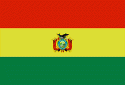
| Flag of Bolivia | |
The sovereign state of Bolivia is a constitutionally unitary state, divided into nine departments. Its geography varies from the peaks of the Andes in the West, to the Eastern Lowlands, situated within the Amazon basin. One-third of the country is within the Andean mountain range. With 1098581 km2 of area, Bolivia is the fifth largest country in South America, after Brazil, Argentina, Peru, and Colombia (and alongside Paraguay, one of the only two landlocked countries in the Americas), the 27th largest in the world, the largest landlocked country in the Southern Hemisphere, and the world's seventh largest landlocked country, after Kazakhstan, Mongolia, Chad, Niger, Mali, and Ethiopia.
Currency / Language
| ISO | Currency | Symbol | Significant figures |
|---|---|---|---|
| BOB | Boliviano | Bs | 2 |
| ISO | Language |
|---|---|
| AY | Aymara language |
| QU | Quechua language |
| ES | Spanish language |


